There is a cafe on a street corner in Paris where, it is said, if you sit there long enough, the entire world will pass by. We found out that there is a bench along the South Rim Trail in the Grand Canyon National Park where this is also true.
The plan had been to take the motor home for a week or so in the high country before the Labor Day weekend. We started north a day later than we had planned due to the unforeseen need to have the pump in our water well replaced. From an engineering standpoint, Al was fascinated by the process of pulling up 520 feet of well casing and cable, then replacing same along with a new pump. My pocketbook was less thrilled, but that’s the price of maintaining your own water system.
I had made reservations in the National Park at the unfortunately-named Trailer Village RV campground for four nights, so there was no great pressure to get anywhere early to snag a campsite. Al had been dreading the climb up I-17 to Flagstaff, but it turned out to be easier than he remembered. In fact, he actually passed a few rigs on the way up, which is unusual for us even on the flats. We took route 89 north from Flagstaff, which is the lesser-used but more scenic route, winding up to 8000 feet through pine forests interspersed with aspen groves before joining the flat boring highway that comes up from Williams. I often wonder if first-time visitors to the South Rim are surprised at the contrast between the flatness of the terrain to the south and the abruptness with which the Canyon itself plunges down and down and down in rugged terraces and pinnacles.
Although Trailer Village sounds like some FEMA relocation camp, it’s actually better than most RV parks, with wide spacing and numerous trees. We were fascinated by the number of Cruise-America class C motorhomes that came in. Al took an informal survey of those closest to us over the four days we spent in the park and determined that the vast majority are driven by non-US tourists—Australians, Swiss, Danes, Germans, etc.

While sipping my morning espresso the next day, I enjoyed arm-chair birdwatching. A little mountain chickadee practically landed in my lap, posing with cocked head as if saying “I’m cute, feed me, feed me, feed me” instead of his usual wheezy chickadee call. There were numerous mountain bluebirds, pinyon jays, Stellar’s jays, a titmouse pair, a lone robin, juncos, and of course, ravens who swooshed by audibly on those massive black wings, so much bigger close up than any of the other birds.

Al decided we should make a recon trip in our own vehicle before committing to a shuttle bus, so we headed out along the Village Loop and scored a parking place between the El Tovar hotel and Hopi House. The El Tovar has sentimental associations for us dating back to our first transcontinental trip together forty-one years ago. Completely unaware that this is a prime holiday destination, we had waltzed in on Thanksgiving Day and literally got the last room at the inn, not a great one but considering the 10-degree overnight weather, it sure beat sleeping in the car. Ten years ago, I had to make Thanksgiving reservations six months in advance but on that visit we were fortunate enough to have a large room overlooking the rim.
This day we found a bench in the shade near the hotel and commenced to watch not only the canyon, which doesn’t move much, but also the tourists and the wildlife. Looking across the chasm at the next section of the South Rim, I noticed some black specks in the sky. The binoculars revealed a California condor, along with two turkey vultures and three ravens, all within the same field of view, offering a textbook comparison of the flight profiles of the three species. The birds shared the same thermal for a while before the ravens started harassing the condor who finally soared off in disgust. We had picked the right moment.
A pair of young Japanese couples stopped to ask directions to the Bright Angel Trail. Al walked them a few feet to the edge and pointed across to where the top of the trail switchbacks steeply downward. Their eyes got big. He then pointed out Indian Garden, a couple of thousand feet below and told them it would probably be a six or eight hour round trip. They had plenty of time, but no water and certainly not appropriate footgear. They wandered off in the direction of the trailhead and I wondered if they would actually start down the trail like so many others who have no real concept of the Grand Canyon.

This is basically the view from the room that we had ten years ago at the El Tovar.
Al had read that the average Grand Canyon visitor spends thirty minutes on the Rim, which is hard to comprehend. But as we walked eastward along the trail past Hopi House, we encountered only three other hikers in 45 minutes. Most people seem to be in a rush to get to their next destination and don’t take the time to really look at the Canyon. Because of its vast scale, the Canyon is something that cannot be easily comprehended by the human eye. We would tell visitors that the North Rim was 20 miles away or that the Colorado River was almost a mile below. Al could rarely resist the impulse to brag about the fact that we had walked to Phantom Ranch and back, which usually brought the desired admiring comments.
We returned to the car so someone else could enjoy the parking place and headed out to some of the viewpoints to the east with a stop first at the General Store at Market Plaza. As usual, I had brought enough food for a small army in case we were marooned on some isolated road for a week or two, but somehow I had forgotten the salt shaker. One pass through the store made me realize that there was absolutely no need to bring food from home as this was a full-service supermarket. In the salt section, for example, there was not only that picnic staple, the Morton salt-pepper two-pack, but any kind of flavored salt you could possibly want: lemon pepper salt, Cajun salt, and so on. There were two different brands of imported sea salt, each of which came in either coarse or fine. The entire store was filled with boggling selections of everything. They must know their market, which is certainly more sophisticated than a camp store would have served a few years ago.
We headed east as far as Moran Point, where we encountered a group of about twenty Italian men who were on a touring out of Las Vegas on Harley Davidson motorcycles. On our way back west, we met a parade of five Cruise American rigs heading east out of the park, each flying a German flag.
That evening we rode the shuttle to El Tovar where we enjoyed a wonderful dinner. First we shared an appetizer of (raw) buffalo carpaccio, then Al had the evening special of sockeye salmon which was an amazingly large portion cooked to perfection. I chose the half-duck which was glazed with a sweet-hot pepper sauce. Both of our entrees were served with broccoli rabe and the longest julienne carrots I’ve ever seen. Al enjoyed a glass of California Merlot while I had a Red Zinfandel, both of which were quite a bit better than our house wine at home which is usually Two-buck Chuck. For dessert, we split a piece of Derby Pie served warm and al a mode. To his credit, Al didn’t even flinch at the bill.
Hermit’s Rest is an homage to a man who lived near the sight for many years, although apparently he was perfectly sociable and not a hermit at all. The building is one of the many Mary Coulter structures that make the park so elegant. Although I normally shun gift shops, a display of miniature Native American pottery caught my eye and I selected a Jemez matrimonial jug to go with the small collection I have at home.

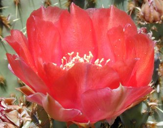
This grouping of plants was just outside Hermit's Rest. I thought it was an interesting combination of desert and mountain species.
By the time we started east, our fellow riders had all disappeared and, as usual, we had the trail to ourselves. The temperature was perfect with a slight breeze and there were numerous views of the Colorado River far, far below, although we never did see any rafts on it during our entire stay. The trail had obviously recently been relocated and resurfaced and along the way we found a small overlook with a convenient rock. It seems that we never tire of meditating on the canyon view and out there it seemed as if we were the only tourists on the rim.

A couple of views of the Colorado River from along the Hermit's Rest trail.

Reaching our limit, we boarded the bus at the next stop, 1.1 miles from our start, sharing the vehicle with a grand total of three other people, all Japanese tourists, two of whom slept the entire time. Guess that power touring of national parks can be pretty exhausting. By the time we reached the starting point it was about 10 am and now there must have been three bus-loads of tourists waiting to board the shuttle. We’re such early birds that it’s hard to comprehend how late most people get started.
Before returning to the car, we detoured a few steps to the top of the Bright Angel Trail where a young couple with outrageously large packs came up the trail and paused at the railing, giving each other high fives. They were obviously hugely satisfied with themselves but I had a hard time believing that they could have come up from Phantom Ranch so early in the day. Al reminded me that hikers nowadays get an early start using headlamps to guide them in the dark.
That evening we went out to Yavapai point to enjoy the sunset, along with several hundred other tourists. Fortunately, there’s a lot of space to watch the cliffs turn brilliant orange and red as the sun goes down. Below is an actual unretouched image taken at sunset. Hard to believe that these colors are natural.

We returned in the morning around 7, too late for sunrise, and walked to Mather Point and back. At this hour, there was hardly anyone around Yavapai Point and again we saw only a couple of people on the trail.

We enjoyed the view of the canyon from a bench, but this fat squirrel was more adventuresome and undoubtedly had an even more dramatic view.
From Mather Point, I got this image of the upper rest area on the South Kaibab Trail. I remember that ten years ago on our way down to Phantom Ranch, we stopped here to remove some of the heavy clothing we’d needed for the sub-freezing temps at the top of the trail. By the time we reached Phantom Ranch, over 4000 feet below, the air had warmed up into the high 80’s. Today, it would reach the high 80’s on the South Rim and over 100 at the river.

Sitting at our campsite before dinner, we spotted a mule deer with an incredible rack of antlers come out of the trees across the road behind the rig but by the time I got the camera, he had melted into the underbrush. Perhaps he was getting out of the way of the bull elk that stepped across the road shortly thereafter. Fortunately, the camera was still at hand. He used those antlers to tear branches off trees so he could browse on them. Crash, crash, crackle. Now I know why there are so many branches on the ground.

The next morning we got up early enough for sunrise at Yavapai Point, an event attended by a lot of folks who were as inappropriately dressed as we were in the unexpectedly brisk wind. Sunrise is a more subtle event than sunset and even after the sun rose above the clouds and began to illuminate the cliffs, the coloration was not as dramatic as the night before.

After the event, we retired to our favorite bench near the observatory and resumed our conversations with the world. One young man, originally from India but living in New Jersey, who had brought his extended family to the sunrise, was quite fascinated by the concept of hiking down to Phantom Ranch. He told us about trekking in the Himalayas near where he grew up and mentioned a 15-day trip he wanted to take there.
After the observatory opened, we stepped inside to appreciate the displays that explain Canyon geology and ended up being the only participants in a ranger-led geology walk. At the end of the walk, I snapped this photo of the top part of the Bright Angel Trail. It’s hard to believe we actually staggered up that steep incline ourselves returning from Phantom Ranch. It’s a good thing we made that trip when we did, because Al and I both agreed that we’re both far too decrepit to do it today. You have to look really close to see the trail, but it's that faint wiggly set of switchbacks that starts toward the right side of the top the green tree in the foreground.

On our way home, we stopped in Prescott to explore the area. We stayed at Point of Rocks RV Park which is right in the middle of the Granite Dells area which, as you can see in the photos, is an extensive and dramatic rock formation. A trip in the car to the west of town took us up to the Granite Basin recreation area, which was similarly gorgeous. Who needs Yosemite when this is closer to home and much less crowded? We continued along the road to Skull Valley, which Al had always wanted to see and which had been a point on the railroad between Ash Fork and Phoenix. We returned via highway 89, which is the “main” highway but which is narrower and more winding, that is to say, more scenic too.

Highway 89 north of Prescott through the Granite Dells.

The "lake" in the Granite Basin Recreation area.

The cafe at Skull Valley wasn't open the day we were there. I'm not entirely sure it's open at all.
The general store at Skull Valley.

The morning view out of the front of the motor home at the Point of Rocks RV Park in Prescot.
The plan had been to take the motor home for a week or so in the high country before the Labor Day weekend. We started north a day later than we had planned due to the unforeseen need to have the pump in our water well replaced. From an engineering standpoint, Al was fascinated by the process of pulling up 520 feet of well casing and cable, then replacing same along with a new pump. My pocketbook was less thrilled, but that’s the price of maintaining your own water system.
I had made reservations in the National Park at the unfortunately-named Trailer Village RV campground for four nights, so there was no great pressure to get anywhere early to snag a campsite. Al had been dreading the climb up I-17 to Flagstaff, but it turned out to be easier than he remembered. In fact, he actually passed a few rigs on the way up, which is unusual for us even on the flats. We took route 89 north from Flagstaff, which is the lesser-used but more scenic route, winding up to 8000 feet through pine forests interspersed with aspen groves before joining the flat boring highway that comes up from Williams. I often wonder if first-time visitors to the South Rim are surprised at the contrast between the flatness of the terrain to the south and the abruptness with which the Canyon itself plunges down and down and down in rugged terraces and pinnacles.
Although Trailer Village sounds like some FEMA relocation camp, it’s actually better than most RV parks, with wide spacing and numerous trees. We were fascinated by the number of Cruise-America class C motorhomes that came in. Al took an informal survey of those closest to us over the four days we spent in the park and determined that the vast majority are driven by non-US tourists—Australians, Swiss, Danes, Germans, etc.

While sipping my morning espresso the next day, I enjoyed arm-chair birdwatching. A little mountain chickadee practically landed in my lap, posing with cocked head as if saying “I’m cute, feed me, feed me, feed me” instead of his usual wheezy chickadee call. There were numerous mountain bluebirds, pinyon jays, Stellar’s jays, a titmouse pair, a lone robin, juncos, and of course, ravens who swooshed by audibly on those massive black wings, so much bigger close up than any of the other birds.

Al decided we should make a recon trip in our own vehicle before committing to a shuttle bus, so we headed out along the Village Loop and scored a parking place between the El Tovar hotel and Hopi House. The El Tovar has sentimental associations for us dating back to our first transcontinental trip together forty-one years ago. Completely unaware that this is a prime holiday destination, we had waltzed in on Thanksgiving Day and literally got the last room at the inn, not a great one but considering the 10-degree overnight weather, it sure beat sleeping in the car. Ten years ago, I had to make Thanksgiving reservations six months in advance but on that visit we were fortunate enough to have a large room overlooking the rim.
This day we found a bench in the shade near the hotel and commenced to watch not only the canyon, which doesn’t move much, but also the tourists and the wildlife. Looking across the chasm at the next section of the South Rim, I noticed some black specks in the sky. The binoculars revealed a California condor, along with two turkey vultures and three ravens, all within the same field of view, offering a textbook comparison of the flight profiles of the three species. The birds shared the same thermal for a while before the ravens started harassing the condor who finally soared off in disgust. We had picked the right moment.
A pair of young Japanese couples stopped to ask directions to the Bright Angel Trail. Al walked them a few feet to the edge and pointed across to where the top of the trail switchbacks steeply downward. Their eyes got big. He then pointed out Indian Garden, a couple of thousand feet below and told them it would probably be a six or eight hour round trip. They had plenty of time, but no water and certainly not appropriate footgear. They wandered off in the direction of the trailhead and I wondered if they would actually start down the trail like so many others who have no real concept of the Grand Canyon.

This is basically the view from the room that we had ten years ago at the El Tovar.
Al had read that the average Grand Canyon visitor spends thirty minutes on the Rim, which is hard to comprehend. But as we walked eastward along the trail past Hopi House, we encountered only three other hikers in 45 minutes. Most people seem to be in a rush to get to their next destination and don’t take the time to really look at the Canyon. Because of its vast scale, the Canyon is something that cannot be easily comprehended by the human eye. We would tell visitors that the North Rim was 20 miles away or that the Colorado River was almost a mile below. Al could rarely resist the impulse to brag about the fact that we had walked to Phantom Ranch and back, which usually brought the desired admiring comments.
We returned to the car so someone else could enjoy the parking place and headed out to some of the viewpoints to the east with a stop first at the General Store at Market Plaza. As usual, I had brought enough food for a small army in case we were marooned on some isolated road for a week or two, but somehow I had forgotten the salt shaker. One pass through the store made me realize that there was absolutely no need to bring food from home as this was a full-service supermarket. In the salt section, for example, there was not only that picnic staple, the Morton salt-pepper two-pack, but any kind of flavored salt you could possibly want: lemon pepper salt, Cajun salt, and so on. There were two different brands of imported sea salt, each of which came in either coarse or fine. The entire store was filled with boggling selections of everything. They must know their market, which is certainly more sophisticated than a camp store would have served a few years ago.
We headed east as far as Moran Point, where we encountered a group of about twenty Italian men who were on a touring out of Las Vegas on Harley Davidson motorcycles. On our way back west, we met a parade of five Cruise American rigs heading east out of the park, each flying a German flag.
That evening we rode the shuttle to El Tovar where we enjoyed a wonderful dinner. First we shared an appetizer of (raw) buffalo carpaccio, then Al had the evening special of sockeye salmon which was an amazingly large portion cooked to perfection. I chose the half-duck which was glazed with a sweet-hot pepper sauce. Both of our entrees were served with broccoli rabe and the longest julienne carrots I’ve ever seen. Al enjoyed a glass of California Merlot while I had a Red Zinfandel, both of which were quite a bit better than our house wine at home which is usually Two-buck Chuck. For dessert, we split a piece of Derby Pie served warm and al a mode. To his credit, Al didn’t even flinch at the bill.
Hermit’s Rest is an homage to a man who lived near the sight for many years, although apparently he was perfectly sociable and not a hermit at all. The building is one of the many Mary Coulter structures that make the park so elegant. Although I normally shun gift shops, a display of miniature Native American pottery caught my eye and I selected a Jemez matrimonial jug to go with the small collection I have at home.

This grouping of plants was just outside Hermit's Rest. I thought it was an interesting combination of desert and mountain species.
By the time we started east, our fellow riders had all disappeared and, as usual, we had the trail to ourselves. The temperature was perfect with a slight breeze and there were numerous views of the Colorado River far, far below, although we never did see any rafts on it during our entire stay. The trail had obviously recently been relocated and resurfaced and along the way we found a small overlook with a convenient rock. It seems that we never tire of meditating on the canyon view and out there it seemed as if we were the only tourists on the rim.

A couple of views of the Colorado River from along the Hermit's Rest trail.

Reaching our limit, we boarded the bus at the next stop, 1.1 miles from our start, sharing the vehicle with a grand total of three other people, all Japanese tourists, two of whom slept the entire time. Guess that power touring of national parks can be pretty exhausting. By the time we reached the starting point it was about 10 am and now there must have been three bus-loads of tourists waiting to board the shuttle. We’re such early birds that it’s hard to comprehend how late most people get started.
Before returning to the car, we detoured a few steps to the top of the Bright Angel Trail where a young couple with outrageously large packs came up the trail and paused at the railing, giving each other high fives. They were obviously hugely satisfied with themselves but I had a hard time believing that they could have come up from Phantom Ranch so early in the day. Al reminded me that hikers nowadays get an early start using headlamps to guide them in the dark.
That evening we went out to Yavapai point to enjoy the sunset, along with several hundred other tourists. Fortunately, there’s a lot of space to watch the cliffs turn brilliant orange and red as the sun goes down. Below is an actual unretouched image taken at sunset. Hard to believe that these colors are natural.

We returned in the morning around 7, too late for sunrise, and walked to Mather Point and back. At this hour, there was hardly anyone around Yavapai Point and again we saw only a couple of people on the trail.

We enjoyed the view of the canyon from a bench, but this fat squirrel was more adventuresome and undoubtedly had an even more dramatic view.
From Mather Point, I got this image of the upper rest area on the South Kaibab Trail. I remember that ten years ago on our way down to Phantom Ranch, we stopped here to remove some of the heavy clothing we’d needed for the sub-freezing temps at the top of the trail. By the time we reached Phantom Ranch, over 4000 feet below, the air had warmed up into the high 80’s. Today, it would reach the high 80’s on the South Rim and over 100 at the river.

Sitting at our campsite before dinner, we spotted a mule deer with an incredible rack of antlers come out of the trees across the road behind the rig but by the time I got the camera, he had melted into the underbrush. Perhaps he was getting out of the way of the bull elk that stepped across the road shortly thereafter. Fortunately, the camera was still at hand. He used those antlers to tear branches off trees so he could browse on them. Crash, crash, crackle. Now I know why there are so many branches on the ground.

The next morning we got up early enough for sunrise at Yavapai Point, an event attended by a lot of folks who were as inappropriately dressed as we were in the unexpectedly brisk wind. Sunrise is a more subtle event than sunset and even after the sun rose above the clouds and began to illuminate the cliffs, the coloration was not as dramatic as the night before.

After the event, we retired to our favorite bench near the observatory and resumed our conversations with the world. One young man, originally from India but living in New Jersey, who had brought his extended family to the sunrise, was quite fascinated by the concept of hiking down to Phantom Ranch. He told us about trekking in the Himalayas near where he grew up and mentioned a 15-day trip he wanted to take there.
After the observatory opened, we stepped inside to appreciate the displays that explain Canyon geology and ended up being the only participants in a ranger-led geology walk. At the end of the walk, I snapped this photo of the top part of the Bright Angel Trail. It’s hard to believe we actually staggered up that steep incline ourselves returning from Phantom Ranch. It’s a good thing we made that trip when we did, because Al and I both agreed that we’re both far too decrepit to do it today. You have to look really close to see the trail, but it's that faint wiggly set of switchbacks that starts toward the right side of the top the green tree in the foreground.

On our way home, we stopped in Prescott to explore the area. We stayed at Point of Rocks RV Park which is right in the middle of the Granite Dells area which, as you can see in the photos, is an extensive and dramatic rock formation. A trip in the car to the west of town took us up to the Granite Basin recreation area, which was similarly gorgeous. Who needs Yosemite when this is closer to home and much less crowded? We continued along the road to Skull Valley, which Al had always wanted to see and which had been a point on the railroad between Ash Fork and Phoenix. We returned via highway 89, which is the “main” highway but which is narrower and more winding, that is to say, more scenic too.

Highway 89 north of Prescott through the Granite Dells.

The "lake" in the Granite Basin Recreation area.

The cafe at Skull Valley wasn't open the day we were there. I'm not entirely sure it's open at all.

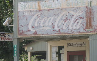
The general store at Skull Valley.

The morning view out of the front of the motor home at the Point of Rocks RV Park in Prescot.
posted by Al and Linda @ 9:58 AM
0 comments
![]()