Time to head home, 1250 miles of mostly freeway driving. It started out pretty well with great views of Mount Shasta, but by the time you get to the great agricultural heart of California's Central Valley, about the only thing you can do is try to figure out what the crops are on either side of the freeway: Almonds, pistachios, walnuts, grapes, almonds, pistachios, grapes, rice, almonds, pistachios, grapes, grapes, grapes, grapes. You get the idea.

Then once you top Tehachapi Pass east of Bakersfield, you're in the high desert and there is nothing to look at but the eighteen-wheelers coming at you and in front of you.

Our reward for the long slog home was seeing these two shining faces when they came home from school.


Al says he's not going to drive anywhere for a long time.
 A family reunion takes a lot of planning, not the least of which is deciding where to get together. Even though there are only four siblings (plus spouses) it was astounding to see the number of e-mails that it took to decide on a location and a date and all the other details. My sister Karen came up with the winning (in all ways) location, Crystalwood Lodge, conveniently located between her home in Klamath Falls, Oregon, and Crater Lake. Located on 130 acres at the north edge of the Klamath Basin, between the marshland and the pine/fir forest, the building began as a family home in 1892 and fortunately has been updated a few times since.
Besides seeing the family and catching up on the current news as well as rehashing our youths, one of the highlights of the reunion for Al and me was the fact that we could go canoeing almost from the Lodge's front door. Crystal Springs arises a few hundred yards down the waterway toward the marshland and the water is as that name suggests: crystal clear. In the morning hours it was also mirror still and I furiously snapped photo after photo of incredible images, only a couple of which I will impose upon you here.


In addition to the many species of birds we watched, from warblers to greater yellowlegs, there were also squirrels, chipmunks and this turtle who wasn't alarmed at all by our silent passing. The advantage of wildlife watching by canoe is that you can glide along so quietly that there is practically no alarm factor, except for the yellowlegs whose approach distance was measured in tens of yards instead of tens of feet. They would sound the alarm, lift off, circle around and land ahead of us where they would have to repeat the process in a few minutes as we advanced along the shoreline. On the other hand, the Virginia rail that was feeding at the edge of the reeds paid us no mind at all.

This is a shot over the misty marsh as the sun came up.

Here's the motley crew: yours truly on the left, then sister Karen, brother Ed and sister Lonna.
Random thoughts about our trip
After three months and many thousands of miles, people, places and events tend to run together. Keeping an organized blog is an excellent way to file memories away for future retrieval. I’m constantly amazed at some of the entries I made about things that later slipped my memory—sometimes it’s almost as if I’m reading someone else’s blog, strange as that may sound. It also helps to write on a calendar where you stay each night. I’m convinced this will provide an alibi some time when I’m wrongly accused of something.
We were very lucky on the trip. We had a couple of repair items: the generator which was repaired in Missouri at a Cummins dealer and the refrigerator, for which Al was able to find a new part and swap it for the defective one himself thanks to Terry Mattson who did all the diagnostic work while we were at that Forest Service campground in Montana. We discovered that getting RV repairs on the road in the summer is next to impossible because everyone is booked up for two or three weeks out. But we didn’t have any really major issues, like the couple we met whose car had literally burned up while it was attached to the towbar on the back of their motorhome. I figure anything less than that is hardly worth mentioning. No medical emergencies other than my trip to a walk-in clinic to get some muscle relaxant to ease neck cramps. No blood, no broken bones.
We had very few traffic problems except for the innumerable construction projects which are a fact of life in summer driving. In spite of all the political posturing, it looked like a lot of states were more than willing to put those federal stimulus funds toward an obvious benefit. On the other hand, we drove some seriously rough roads and ended up losing two hubcaps.
Despite what you see on the evening news, most people are really nice. Maybe the cranky ones steered clear of us.
There are places in this country of ours that we never imagined we’d enjoy so much. In fact, we found something interesting almost everywhere we went. Of course, it helps to be interested in almost everything.
One disappointment was the almost total lack of small town cafes. I can remember traveling with my parents (yes, when dinosaurs roamed the earth) and eating at local cafes. Nowadays, it looks like the businesses have either moved out to the interstate interchange, where you find pretty much only chains, or lacking an interstate, the businesses have simply closed for lack of trade. So many of the small towns we drove through were visibly struggling and I suppose that eating out is one of the things that people cut out of their budgets in hard times. I used to think Walmart was a bad thing for driving local grocery stores out of business, but those groceries are closed even when Walmart is nowhere near. Now I think Walmart might be a blesing because otherwise many people would have no access to a good selection of products at a reasonable price.
Having an iPhone is a big help in many situations. Assuming, of course, that ATT has deigned to extend cell coverage to the part of the world you are currently in. I thought about making a list of all the places where we had no coverage and submitting it as a rebuttal to the “more bars in more places” campaign. I have formed the opinion that although the wireless providers nominally pay for the right to the airwaves, they are still using a public resource and they should be obligated to provide their services everywhere in the country.
There is nothing in the world to compare to a four-year-old grandson telling you on the phone that he wishes you would come home.
We can thank the railroads for time zones. Before the railroad came to town, each community was free to set its own local time. But how do you know if the railroad is on schedule, or even what the schedule is, if everyone has a different idea about what time it is? So with the coming of the railroads came standard times.
England went to standard times in 1847 but the US didn’t until 1883. To quote from Wikipedia
“Timekeeping on the American railroads in the mid 19th century was somewhat confused. Each railroad used its own standard time, usually based on the local time of its headquarters or most important terminus, and the railroad's train schedules were published using its own time. Some major railroad junctions served by several different railroads had a separate clock for each railroad, each showing a different time; the main station in Pittsburgh, Pennsylvania, for example, kept six different times. One can imagine the confusion for travelers making a long journey that involved several changes of train.”
Despite the needs of the railroads, it is still true that each location has its own “sun time” on any particular day of the year. When you are traveling, you begin to notice that the sun didn’t come up the same time this morning as it did yesterday when you were 250 miles farther west or 200 miles farther south. At some point, you have to say to heck with it and go to sleep while the sun still shines and get up before it does, or vice versa.
Changing time zones have affected almost everyone who has traveled any distance from home, especially if they have gone a long distance by airplane. Most vacations involve changing from one’s home time zone to one other time zone, for example when you fly to Hawaii or to Paris. We all know how difficult it can be to adapt to that new time zone, to adjust your body to sunrise and sunset in your vacation spot. Imagine if you change mini-time zones every day.
When I lived in the south, Florida to be precise, where the length of the day does not vary dramatically with the seasons, I was surprised that some people simply did not believe me when I told them that winter days were short and summer days were long in the Pacific Northwest, from whence I had moved to Florida. Haven’t you heard of the midnight sun in Alaska’s summertime, I would ask. Yes, of course, they would nod. And haven’t you heard that also in northern Alaska the sun never rises in the wintertime? Oh, yes, they would agree. Well, then, can you understand that there is some point between Alaska and Florida where summer days are shorter than in Alaska but longer than in Florida? Ummm, no… It was amazing how many people could not understand the effect of the seasonal movement of the planet and the relationship to the length of the day/night at any point on the globe. Well, friends, all you have to do is to travel from south to north and you will observe with your very eyes the effect of latitude on the length of the day.
When we travelled from Ocean Springs, MS, to St. Charles, MO, both within the same Central Time Zone, the length of the day (sunrise to sunset, not the number of hours!) changed by about 45 minutes. I haven’t measured it precisely, but that distance is only a fraction of the distance from Ocean Springs to northern Canada at the same latitude as northern Alaska. So the farther north we go in the summer, the more daylight we get.
As I write this in Montana, I’m enjoying about an hour and a half more daylight than I would be at home in Arizona. Of course in Arizona in the summer, you really don’t want the sun to stay up any longer that it absolutely has to, one reason that Arizona doesn’t observe daylight time. On the other hand, the Navajo nation does observe daylight time, which can make it very confusing, but since Gallup NM is a main trading center for most of the Navajos, even those who live in the part of their nation that is in Arizona, it apparently works better for them to stay in synch with the rest of the Mountain Time Zone and not worry about those folks in Phoenix. Which seems fair because the folks in Phoenix don’t worry about the Navajos a whole lot anyway.
Fortunately, being retired and not being on a schedule, we can get up and go to bed when we doggone well please, time zones and latitude be darned.
Klamath Marsh is a premier birding spot during migrations but of course we were here the wrong time of year. We did see an adult sora rail with a juvenile working the mudflats near some reeds, but other than a few ducks, hawks and the ever-present great blue herons, there wasn't much going on. I've never seen a great blue heron posing quite like this before.


Crater Lake is one of those western American icons, a place everyone has seen in travel ads if not in person. We hadn’t visited the park for many years and we had never driven around the entire rim. On previous trips we had done like most other people do, treated the lake as a drive-by: in one end of the park, around part of the rim, and out the other end of the park. In some ways, a trip around the entire lake gets monotonous because there is just one drop dead gorgeous view after another.


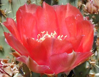
The wildflowers were still blooming at the rim drive’s elevations but it was only on the east side of the lake that the conditions were apparently ideal. I wasn’t able to get any shots of the most spectacular “gardens” since they were invariably no where near where a car could stop, but there were roadside cliffs where a dozen different species of flowers were blooming, then a couple of miles along a different dozen species of flowers crowded the roadside. These are a few of the images I was able to preserve but they only give a tiny sampling of what the drive offered.


The Oregon Trail intersected our westward path somewhere in Idaho along the Snake River. At Glenn’s Ferry we took a slight diversion to take a look at the Three Island Crossing where the pioneers had to make the choice between a dangerous crossing of the Snake River here or a dangerous crossing farther west.
On the way back to the freeway, we were stopped at a railroad crossing behind a pickup truck towing a fifth-wheel trailer. The train inched westward interminably, then the crossing gate lifted but, I noticed idly, the red blinking lights stayed red and blinking. The pickup truck crossed the tracks, or more significantly the first set of tracks, and the crossing gate came back down square in the middle of the top of the trailer. Ooops. There was a train going eastbound on the second set of tracks. The pickup truck drove forward enough to clear the first tracks and the crossing gate bounced a couple of times on the trailer roof then came to rest in its normal position. The driver came out with a disgusted expression and surveyed his position, then moved the truck a bit forward at an angle to ensure track clearance by the trailer, then came out and surveyed things again, his whole posture expressing his disgust. The eastbound train moved on by much more rapidly. The moral of the story is, even if the crossing gates go up, wait for the lights to stop blinking.
When the last train had passed, I snapped the two images below of old buildings on the far side of the tracks. Don’t they both have the most marvelous aged patinas on the brick and rock respectively? I’d love to reproduce the effect on model buildings for our G-scale railroad.


Eastern Oregon is wide and sparsely populated, at least on the route we chose, US 20 through Burns to Bend. I had wanted to travel the more northward US26 in the belief it would be more scenic and less barren desert but Al had checked the map thoroughly and determined that there were fewer mountain passes on US20. As it turned out, US20 was as scenic as you would want, following the path of Malheur River for much of the distance to Burns. The road winds through dramatic rock outcroppings as it works its way up into the mountains.

West of Burns, the mountains spread out and the effect is more of the high desert but it had obviously been a wet year and the vegetation was much greener than we expected, especially in the areas of irrigated hay fields. This is such a classic image of the American open road.

Soon we came over a rise and got our first glimpse of the Oregon Cascade Peaks.

We stayed one night at Crane Prairie Reservoir, southwest of Bend and although the winds had been ferocious the day before, in the morning the lake was like the proverbial mirror, here seen reflecting South Sister, Brokentop and Mt. Bachelor.

The Snake River continued to follow us across Idaho. Now it is no longer free flowing, but has been dammed in several places. We stayed west of Twin Falls in the little town of Hagerman. The temperatures were in the mid-90's and Al grumbled about why weren't we home if it was going to be this hot.
Along the Thousands Springs Byway, you can at least get the image of coolness from the water falls that spring from the lava cliffs above the Snake. The lava formations here are very porous and move vast amounts of water underground across the Snake River Plain. The water then emerges from the lava along this stretch of backroad to rejoin the river. Note that there is no "river" feeding these falls from above--they really do emerge from the cliff, thence the designation "1000 Springs."


The land around here is intensely agricultural and is a prime example of how the sagebrush desert can be turned into a garden spot given enough water. The fields are full of alfalfa, grass being grown for silage for the many dairy farms, corn, potatoes, wheat, all of which is being irrigated from water in the various reservoirs. Al enjoyed the feel of the area, probably harking back to his (nonexistent) farmer roots. Right about now he's longing to get back to his Apache Junction roots. A loop into Oregon, then we'll point the rig toward Arizona.
Jackson Hole Wyoming, one of those place names that evokes scenic views, the place where the mountain men had their fabled rendezvous, an area teeming with wildlife, the “old west” (whatever that might be) and today, one of the narcissistically self-described “last best places” where rich people have homes that they use a few days a year. Son Alfred and his wife Mindy had vacationed there three years before and were quite taken with it, so we decided we had to see it for ourselves and find out what the attraction was.
A day trip from Idaho Falls takes you along the Snake River, which becomes more and more scenic as you travel toward its source at Jackson Lake. I have never seen such a density of ospreys and osprey nests with occupants. On much of this trip, whenever we have been near water, we’ve been seeing ospreys, but this area along the Snake River had more than any other single stretch we traveled.

The river also becomes more and more populated with fishermen in small river boats, fishermen along the shore, kayaks, canoes, small rafts, big rafts, and generally a lot of people enjoying their vacations. Lots of people. The scenic highway was full of RVs and motorcycles.
The town of Jackson itself was a scene of virtual gridlock-- jaywalkers, jammed parking lots, sidewalks overflowing with humanity going from here to there in a daze, lots of cute gift shops and restaurants. You have a lot of time to examine the pedestrians and the shops and restaurants while you're sitting in traffic. In short, the kind of place we avoid like the plague.
Slightly traumatized, we continued driving past town toward Grand Teton National Park. Once you get past the north end of Jackson, the scenery changes and the Tetons jab into the sky across the valley. The Teton Range extends a comparatively short distance but it is incredibly spectacular, rising from the valley floor in sheer rock faces to form this jagged skyline.

I remember reading a comment once that the old French trappers who named the range must have been a long time without women to liken these peaks to a woman’s bosom. Either that or they’d had some really bad experiences with the opposite sex.

Amazingly, we had excellent cell phone coverage. Or maybe not so amazingly since I imagine that the rich folks who infest the Jackson area insist on their city perks. On the way back to town, I called Mindy to ask her what we should be looking at to understand why they had found the area so wonderful. In the course of the conversation, we both realized the problem: their visit had been in September when all the crowds had gone home. She told us where to find the Jackson Hole ski area where they had taken a tram ride to the top since I wanted to do the same. Al really doesn’t enjoy these things as much as I do, but bless his heart, he always gamely accompanies me.
Alfred and Mindy and the grandchildren had emerged from the tram into the iciness of a September snow squall. This day was almost perfect, with a few clouds to set off the views. As you can see from these shots, the flowers were still blooming at the 10,400-foot level to which the tram takes you.


Here’s the view down the tramway. A long way down.

There were a number of parasailers riding the wind currents down to the bottom. I would love to be able to do that but I’m afraid my bionic knees wouldn’t survive the landing. Better to take the tram back down again.
The ski area is in the Teton Village area, away from Jackson proper, and does have a totally different feel to it, less hectic, but certainly just as luxurious, with residential prices rising into the stratosphere. Who wouldn't like to be able to live here?
On the way back to Idaho Falls from Teton Village, we drove over Teton Pass which tops out at an elevation of 8431 feet. Not only is it nice and winding, there were lots of signs like this one. Good thing we didn't have the motorhome.

Little red squares on the map indicate points of interest. The one west of Idaho Falls, Idaho, was cryptically labeled “EBR-1 Natl Historic Monument”. What the heck was an EBR-1? I asked Al, who shrugged and continued driving down I-15. A small display ad in the Idaho Falls visitor guide that I picked up in the office of the RV park explained it all. EBR-1 was the very first nuclear breeder reactor and the first nuclear power generator. It was open to the public. This we had to see.
First you drive the two-lane across the high desert of Idaho, toward a place called Craters of the Moon, which pretty much describes the barrenness of the landscape. 
Forty-plus miles west of Idaho Falls, a square brick block of a building hunches all by itself on the windswept plain. Isolation was the plan and isolation was what they got.

A perky young lady offered us a guided tour, which we wisely declined because we spent far more time on certain displays than I’m sure any one else would have. The brochure for the self-guided tour and the displays provided an excellent lay-person’s explanation of both the processes involved and the significance of the work. Of course, both Al and I may have a bit more education along these lines than the average tourist, but we found the whole exhibit informative and interesting.
The facility was built on a former Navy test firing range immediately after WWII and it is awe-inspiring to realize how these dedicated men and women created the peaceful atom using technology that now seems absurdly primitive. This view of the control room shows panels of analog equipment, pens scribing lines on rotating discs of graph paper and the kind of dials that are now laughingly referred to as steam-gauges when they are on our airplane control panel.
 Fascinated, Al read the corporate names on the instrumentation, a litany of by-gone manufacturers, most of them dating back to before the time of dinosaurs when he went to engineering school, and most of them as extinct as the dinosaurs or long since merged with today’s corporations.
The facility was decommissioned over forty years ago and any radioactive materials have long been hauled away to what is, I’m sure, some nice secure nuclear waste storage area. Today, you can look right into the heart of the reactor and understand the mechanics of bringing the fissile materials together to create nuclear reactions. Uranium and plutonium are incredibly dense and heavy, so there is a lot of material handling equipment, much of which was designed to be used by remote control. You can even try your hand at manipulating a robot arm to stack blocks. It’s all very interesting if you are a science/engineering nerd.
Al was especially delighted that there was a large-format thick paperback book explaining the history of this facility as well as the other nuclear installations that have been built in the area and it was available for the asking. I’m sure most people don’t ask, but he spoke to the tour guide and she said she’d give him one before we left. She greeted us near the end of our self-guided tour and presented him with his very own copy of "Proving the Principle, a history of the Idaho National Engineering and Environmental Lab."
I had felt bad that our would-be guide had no takers for the tour while we were there, but she filled me in on some of the “interesting” people she encounters. We agreed that the general public has very little understanding of nuclear issues because of the deplorably low level of science education and also the fact that it is a difficult subject. Much easier to listen to the radicals on both sides who tell you what to believe. It seems that the anti-nuke crowd comes in to see the devil in person. She has had visitors come in with face masks to avoid breathing in the contaminated air. The day before we we were there, one visitor had pulled the hair of the other guide, convinced that it was a wig because she must surely be suffering from radiation sickness and losing her hair. Almost worse are the know-it-alls who come up with arcane questions to stump this poor intern who is studying communications at university, not nuclear engineering. People are truly amazing, sometimes even more so than nuclear reactions.
I-15 heads into the mountains between Great Falls and Helena. It follows the Missouri River, which seems to be an inconsistent theme in this trip, the way we keep encountering it, as well as Lewis and Clark, in widely separated places. Those guys got around even more than we do, but then they had a couple of years. This image was taken as the interstate made the transition from the high plains into the real mountains and that blue water is the Missouri on its way to the three streams that combine to make it.

We thought these folks had built in a pretty nice setting along the Missouri, convenient to fishing as well as the mountains.

Our destination was Georgetown Lake, about 25 miles west of the old copper town of Anaconda. Our friends Terry and Cindy Mattson have been spending two or three weeks a year there for the last ten years and we wanted to see what the attraction was. Here's a view of the lake from the road going into the Forest Service campground (translated as absolutely no amenities other than a paved parking pad and pit toilets) where the Mattsons go every year.

Here's the view from the campsite.

Every morning the red-necked grebes would call across the water and we'd watch them feed their young. The big attraction is fishing and most of that is done with flies, meaning that most of the fish get thrown back. The Mattsons were considerate enough to save some trout for our dinner one night and these nice fat Rainbows were mighty delicious.
A few miles west of the lake is the small town of Phillipsburg, which has transformed itself from a dying mining town into a tourist draw. It had one of the most attractively restored downtown areas that we've seen on the trip as you can see from these photos.


Our visit coincided with the Rocky Mountain Accordion Festival and Al wished we had planned ahead to attend some of the events. As it was, he spent some nostalgic time in the local historical museum reliving his youthful accordion enthusiasm with the modern instruments that were on display and discussing them with the sales rep. One highlight of the festival was the parade, which went west on the two blocks of the main street and then turned around and retraced its path in case anyone had missed it. I was able to get the entire parade into a single photo frame. The accordionists were having a lot of fun and so were the appreciative spectators.

The Mattsons kindly drove us in their 4WD vehicle up to the ghost town of Granite, which sits a thousand feet up a steep hill from Phillipsburg. From the "road", you can see traces of the old 9000+-foot long tramway that transported ore down to the smelter in Phillipsburg. Not much is left of the town, but there are interpretive signs that tell you what had been where. This rock vault is all that is left of the bank.

When the mine was in operation, the stamp mills must have been an overwhelming sight, but all that remains today is the extensive rock work. That's the Mattson's dog Boots in the lower right, not a wild animal.

Here's the view down into the valley from the Granite ghost town toward the site of today's Phillipsburg, a thousand feet below. Al gave a lot of thought to the logistics of operating a mill in such a location, wondering how they got building materials, equipment, even food up the steep slopes in the early 1890's. I wondered if the ladies who inhabited the red light district had to walk up the hill themselves or if they were able to get rides on supply wagons.

Georgetown Lake is at an elevation of 6300 feet and so there were still wildflowers blooming at the end of July. Here are a couple of examples.